Leaderboard


Popular Content
Showing content with the highest reputation on 03/05/2022 in all areas
-
The Oliver service department utilizes ASI 335 white & clear silicone, Red Devil butyl sealant, butyl tape, and Dicor self-leveling sealant to re-caulk/reseal the exterior of your camper. This process is based on years of experience here in the Oliver service department addressing and preventing leaks on our trailers. The primary goal when re-caulking/resealing at service intervals, especially roof penetrations, is ensuring there are no leaks. The roof is an area that is not typically seen unless you climb up on top but, again, is the most likely area for a leak to occur. Due to Oliver’s double fiberglass hull construction, any leaking water is trapped between the hulls until the water can find an escape point. Those points are typically a window cutout or one of the weep holes in the lower outer shell. Windows being a primary entry point often leads to an initial diagnosis that the window is leaking which is not necessarily the case. During the yearly maintenance, the exterior is sealed with the appropriate ASI 335 silicone. Once the silicone is cured, bolts and screws located on the roof then have an additional application of self-leveling sealant to provide an additional layer of protection, again, these areas aren’t typically seen to affect the aesthetics of the trailer. The additional layer also helps protect the silicone from sun exposure as well as sealing the head of screws and/or bolts. This precautionary step can be removed from the process if you prefer to have neat caulk seams over the extra protective layer of self-leveling sealant. The primary goal here at Oliver is to provide you the customer with a trailer free of leaks for enjoyable camping adventures.7 points
-
WELCOME TO NORTH DAKOTA. It does get cold in the winter, but the ice and snow are usually gone by June, We get some strong winds, but it keeps the mosquitos away, Yes, we get hail (May-Oct), with some damage, and we have had a few tornados up here, but earthquakes are not common or strong, We keep SnySdUp in a heated Quonset during the winter, no hail damage, but a few dings from rocks whilst out on the road.4 points
-
It only hurts for a short time. You will forget all about it once you start using your Ollie. And less expensive than a BOAT. Break out another thousand!!4 points
-
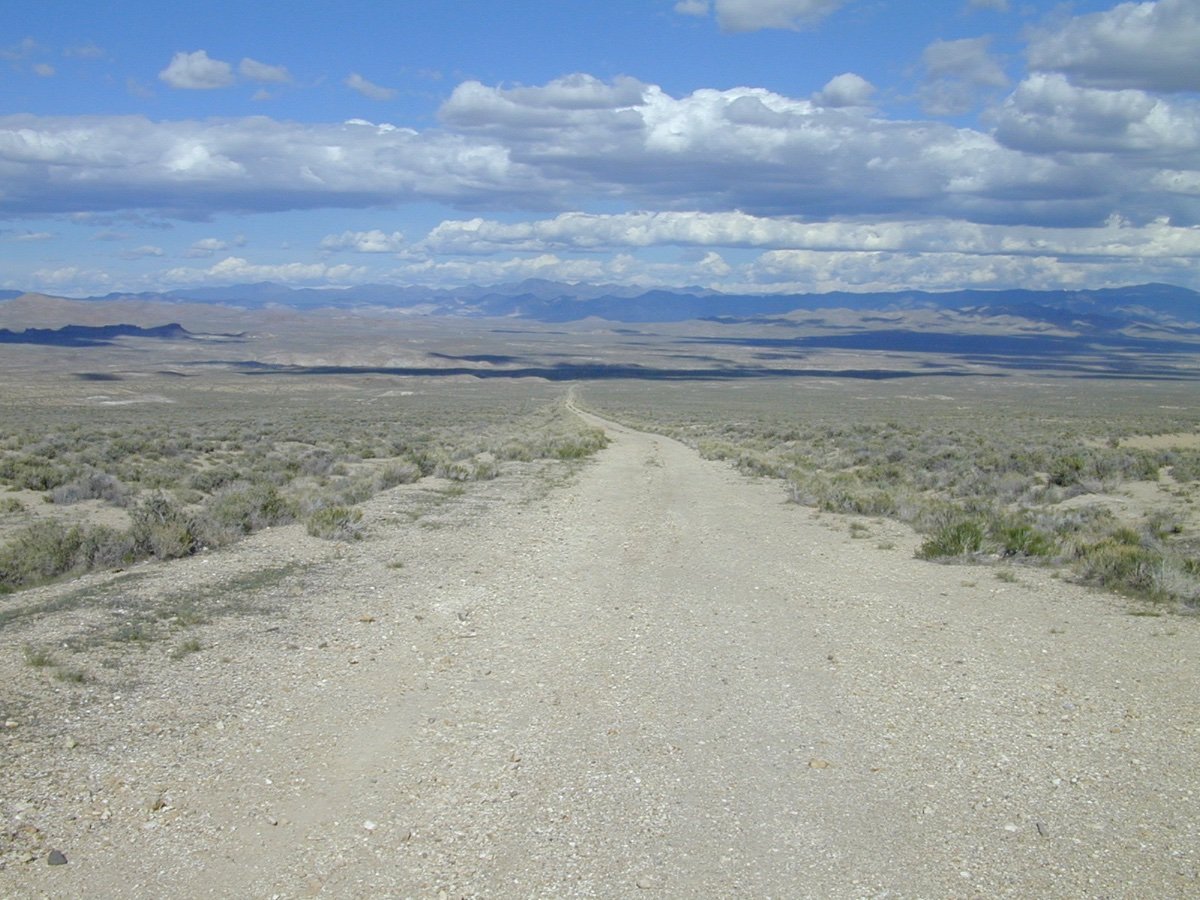
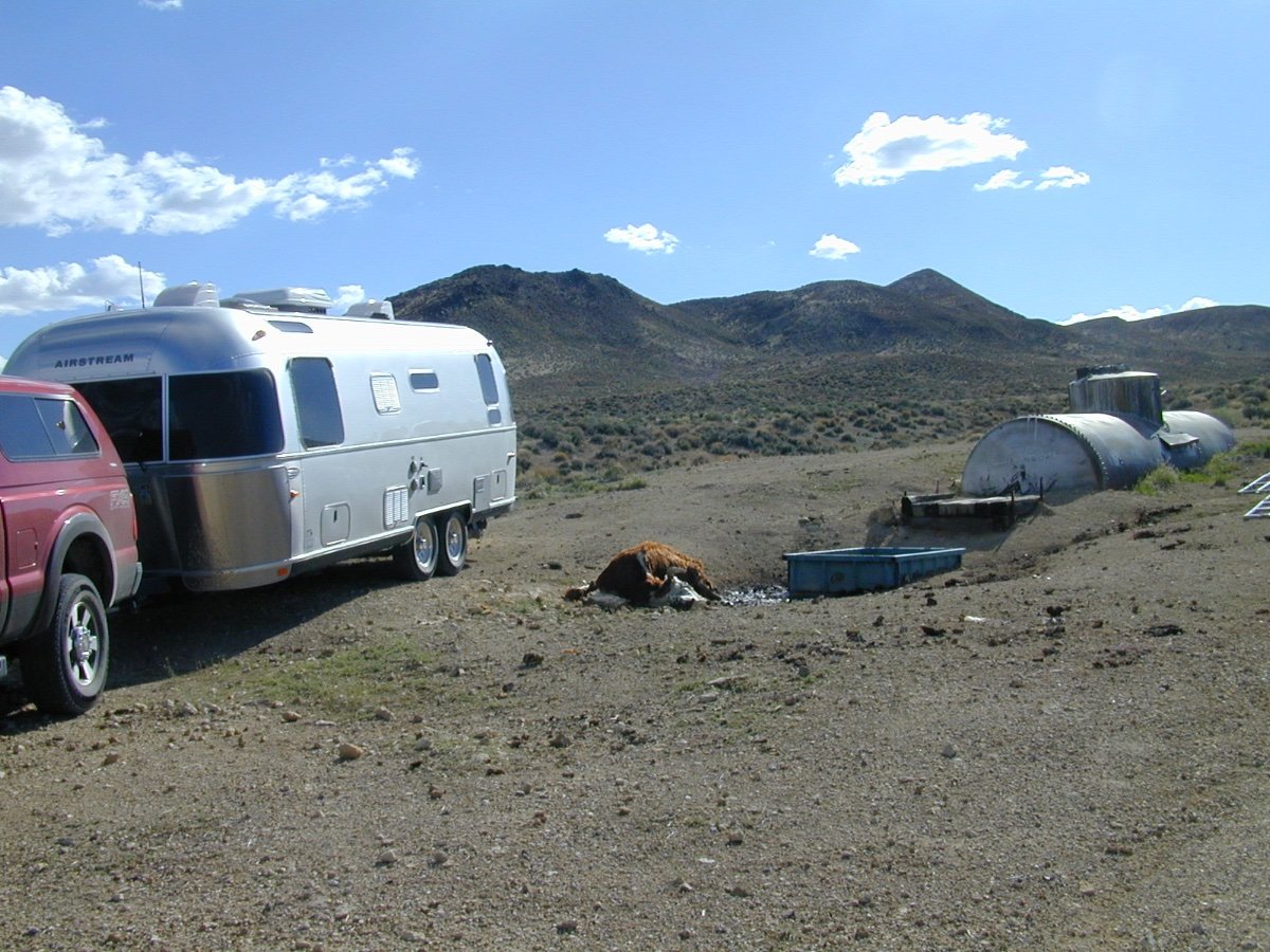
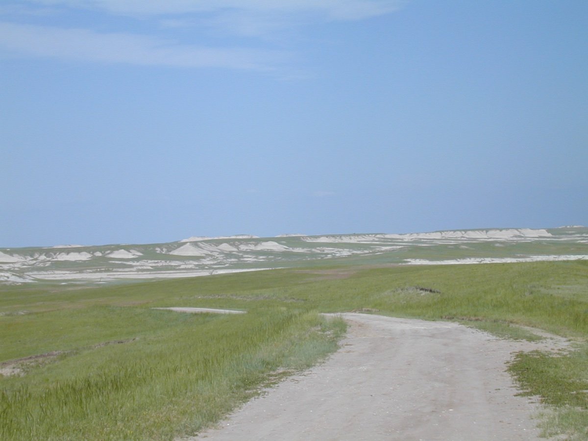
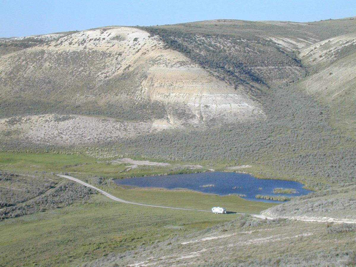
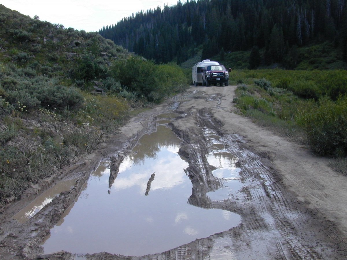
The Western USA, Rocky Mountain States have many End of the Road opportunities. Here are some examples. When you find ONE... mark it on your MAP. These places are becoming scarce. If YOU encounter The End of the Road... lay back and make yourself comfortable. When rested... turn around and go the direction you CAME to the End of the Road. Ahhhh. Wyoming has many EOR's as an example. These photos are from New Mexico, Wyoming, Nevada, Utah and Nebraska. Ahhhhh. Once you get there... it is the END. Lay back and enjoy Peace and Quiet. Although... there are also others... like yourself... who are also Looking for the End of the Road. Enjoy this year... if possible. 🙂
 3 points
 -
We stayed at Great Basin on our way home from Utah last year the end of May . . . . beautiful park. Drove in, with no reservation . . . . . a lot of sites open at Lower Lehman CG. I would suggest Upper Lehman CG as it was hard to find a level site at the lower CG. The drive up to Wheeler Peak is beautiful; it was open, but trails were still snow covered and we didn't have snowshoes 😀
3 points
-
This may be the post you were looking for: Mossey3 points
-
Certainly cheaper than the 2023 model!!3 points
-
At 71.5” the Elite II is no problem. I did meet an Elite II owner at Catalina State Park in January who seemed to be at least 6’6”! Maybe he @Mountainman198will chime in! Mike3 points
-
I can tell you that since I made my 50% payment, nothing can wipe the smile off my face!3 points
-
I carried a TPMS unit with me to install at the factory. Rolled out to the campsite without doing it. Decided that losing fingers in 28 degree rain was not worth installing them on the trip. Risk of losing fingers vs risk of brand new tire blowing out came down on the fingers side of the equation. Possibly I have an unreasoned faith in the tire manufacturers. Installed the TPMS in 75 degree temps on the driveway today 🙂 Fortunately, traffic on the way back was calm so no crash stops. Focused on burnishing the brakes on the Ollie, light to medium braking. Eyesight kicked in a couple of times and I saw the indicator on the Redarc go red, so I know that the wiring harness is correct and the automatic brakes are being relayed to the trailer. I have, had not pulled the trigger yet, but this sounds like a good excuse. I will tell Rebecca that "John said I need one." 🙂 I need to verify this, but my understanding is that the Subaru factory harness on the Ascent does not support pushing charge power back to the trailer. Unlike a truck, the alternator is not sized for charging loads. However, this is based on reading the Ascent forums as well as the owners manuals, which can be a bit contradictory at times. Will do some work with the old multi-meter and try to update on the charging. On this trip it was raining and grey all the time, and I know that we got to our second night with the batteries at 80% after running the fridge all day. So definitely something I need to get a better understanding on as we want to be able to do some light boondocking in the near future. Reset is equipped with the 2022 Lithium Plus package for the Elite I, so two Lithionics batteries and the rooftop solar. Will be reading all the back posts in the forum on care and feeding for those. I had a Forrester with the CVT when we started looking at our Happer Camper HC1 back four years ago. The HC1 is about 990 lbs dry and likely 1200k the way we had it kitted out. When I discussed it with our Subaru tech his comment was "I'm in service, not sales. However, I would not recommend anything more that utility towing with the Forester. The Outback has the CVT setup properly for small travel towing. I would not be surprised to have problems on a Forester CVT with that load." Good advice is invaluable. We replaced the Forester with an Outback. Lots of trips over four years, including a Dallas, New Mexico, Colorado, across Death Valley, Los Angeles, Phoenix, and Arizona trip. That one made liberal use of the paddle shifters in and out of Phoenix and through the Durango area. No issues with the CVT, traded the Outback with 100k miles in great condition on the current Ascent. You are absolutely correct - being on top of the fluid changes is key. I am one of those people who has the dealership do all my adjustments and fluid changes so they keep the Subaru approved stuff in and I always discuss the "suggested" service bulletins so they are generally keeping up with the hidden ones as well as the public ones. Thus the relationship with my Subaru tech and the reason he felt comfortable shooting straight with me. Fun fact - my son currently drives my older 2004 Forester (not the one mentioned above but it's predecessor) with over 360k miles. 🙂 Pre-CVT of course. Now - Tow - Haul setting. That's a bit of black magic on the Ascent, lots of people have lots of opinions. You can't use anti sway hitch on an Ascent since it has special anti sway capabilities built in that are activated when it detects a connected 7-pin. No idea what else is activated when that 7-pin goes in, however just from "feeling" the way it changed after picking up the trailer my gut tells me that they are tweaking the shifting and power ratios. Love the questions, makes me think through things and possibly gives me questions of my own. Will post more photos - after I get the road salt and grime off of Reset. Appreciate the fix on the photo - I need to play with photo posting on this forum. iPhone photos and the new heic format are a PIT* when working from the laptop. And now - without starting a new post... Of course everything was dormant grass wise, I don't know when they laid it down but I don't think it got much time to get settled before the winter. The worst thing was the drainage around the pad - I thanked them for the "lakefront" camping spot (Slot #1) for our overnight stay. I looked out of the trailer around midnight the little lights that mark the edge of the pad were glowing underwater at the rear of the pad. In the morning one had broken half way free and was floating. These are the stock wheels for the Ascent Limited (think they are the same on the Touring but not sure), I do like the way they look. When I first started looking at the Ascent platform I felt it was a bit clunky, but have come to really appreciate the details of "Blue Moose" in our first 4k miles. Thanks John for all the great questions - I don't think I missed any 🙂 Kevin2 points
-
We will be taking our 2019 Oliver II out this Spring. Our first year experimenting... with Getting TO the FINDING End of the Road... Oliver Style. I spent two days using nearly a half of a bottle of Rejex Polymer to get DINGO the Oliver II ready to find the Beginning of the Road to get to the End of the Road. But return home, unlike some of those trailers that just did not make it back. Where are your photographs of the END? Maybe just the beginning and then turned around... End?
2 points
-
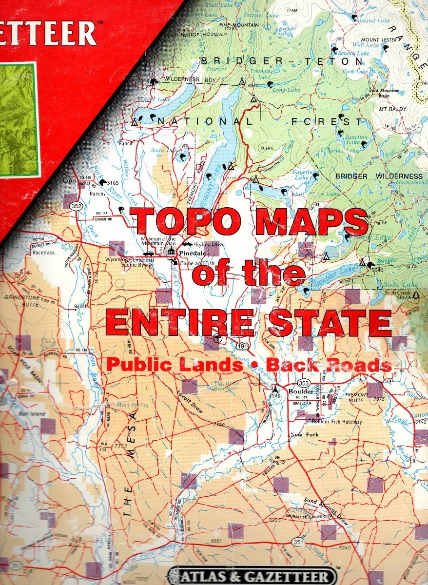
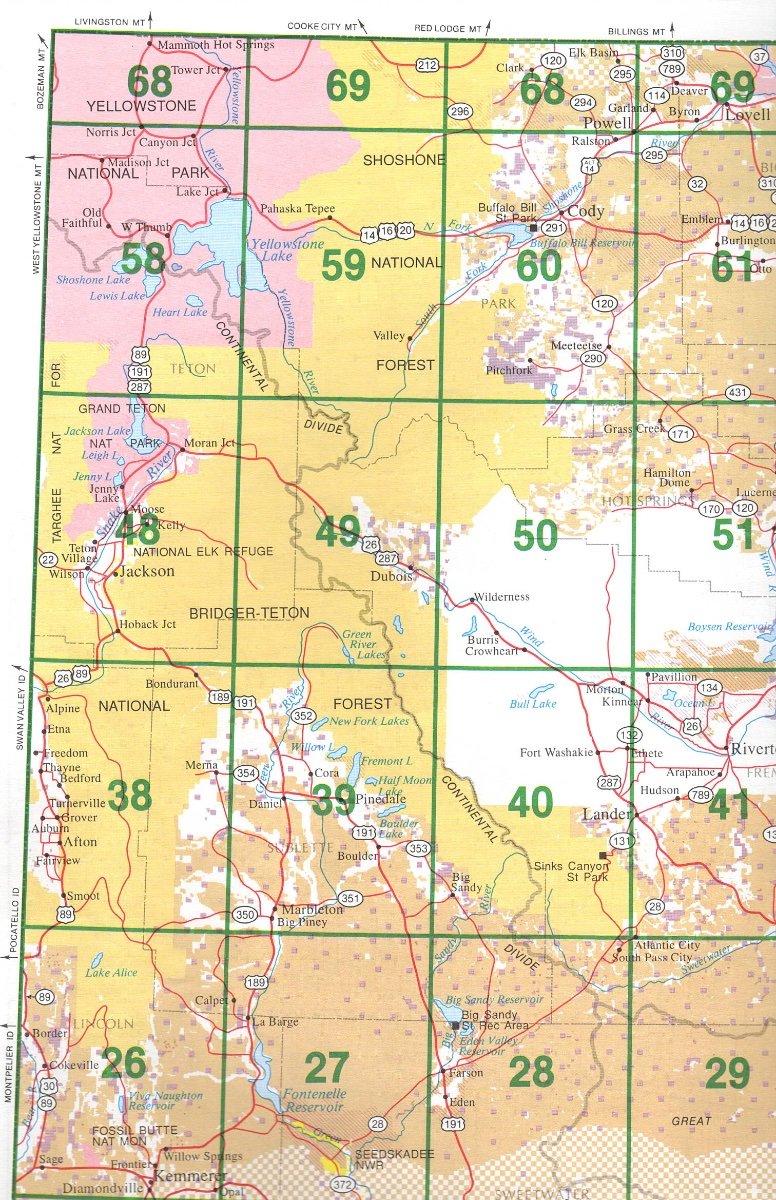
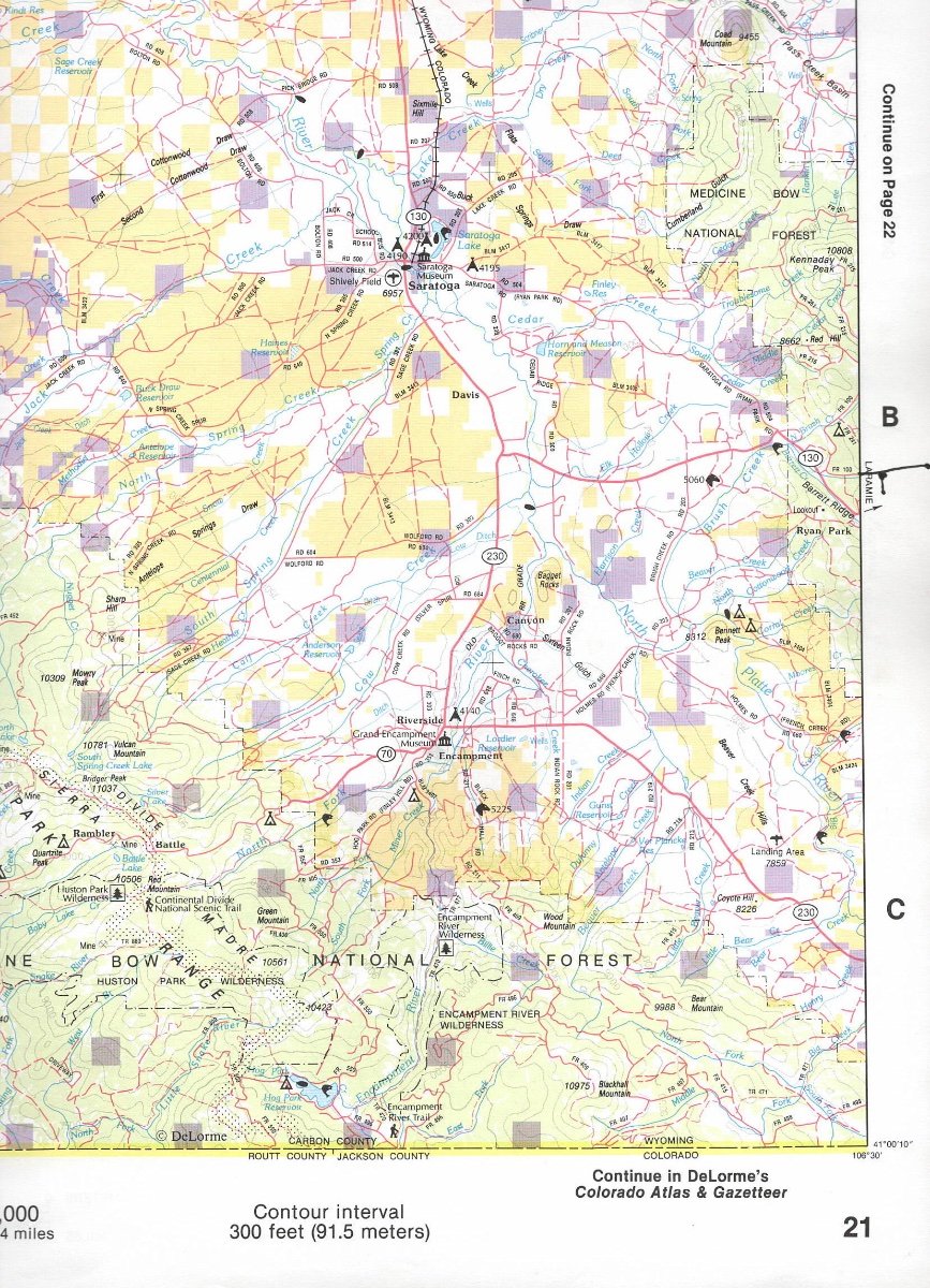
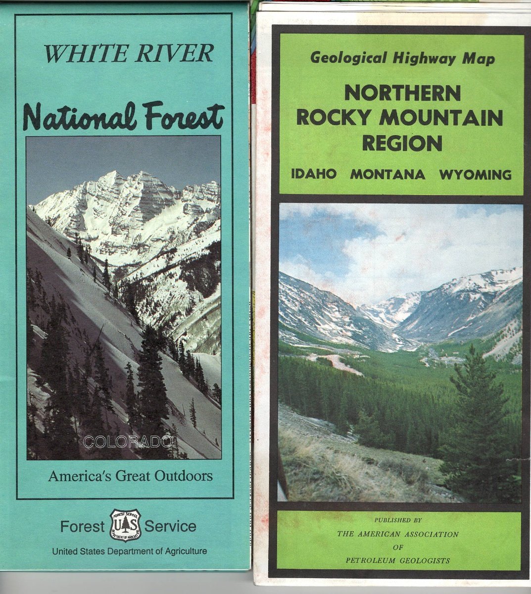
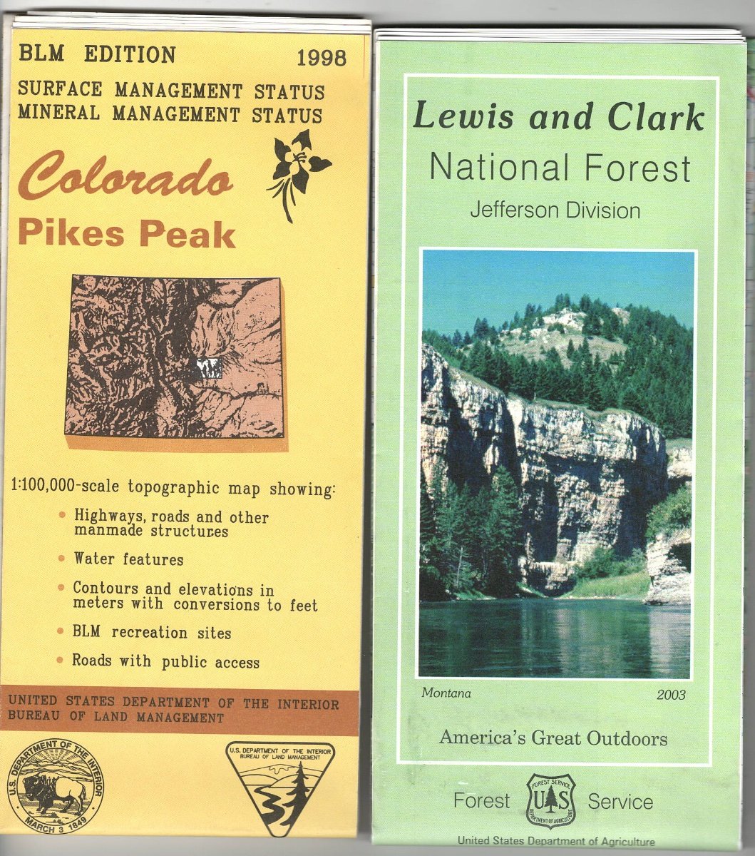
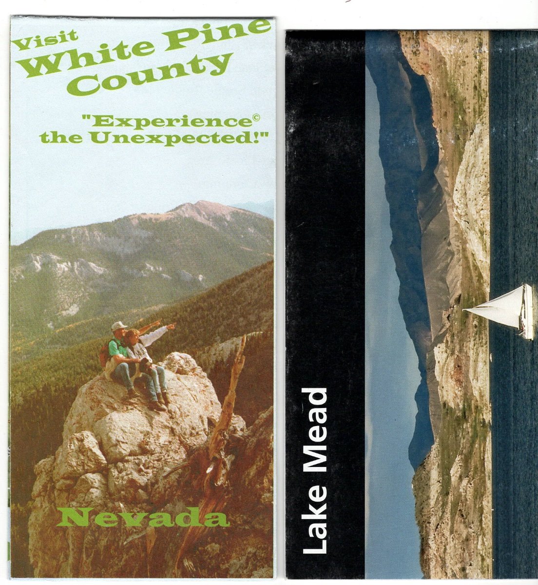
DeLorme Atlas and Gazetteer: Topographic Maps of States I am a Geologist. We do have GPS. We use a wrist GPS to mark where we park our Trailer, our Tow Vehicle when hiking to relocate where we parked and even can Store locations we like. (Garmin Forerunner GPS... over 15 years old and still works.) We do not need an expensive or inexpensive large system with details we do not need. The wrist watch GPS units now are even more sophisticated. We like ours. We park, get a GPS location marked and go. When we want to return to the vehicle, we know the direction to hike, how far away we are. Often not a straight line, as we are in a Canyon, on the other side of a Mountain. Never been lost WITH the GPS watch. We DID get Disorientated ONCE in the wilderness of the Gila National Forest over 15 years ago. I had a Compass... but when we hiked West to the North/South dirt road... it was do we go South or North. We went South and in less than two miles... found our Airstream Trailer. Whew.... First chance... found the Garmin. I advise this BEFORE getting any fancy hand held system. I keep DeLorme Atlas & Gazetteer of All Western States we camp. Often they are on Sale. Newer ones are often improved with more detail than older editions. We have the older and when they get worn, get a newer Edition, but keep both. We MARK ALL OF OUR CAMPSITES ON OUR DeLORME ATLASES. Date, elevation and if we liked or did not like the campsite. Yes... some of you want the most up to date, sophisticated electronics. Good. But... not us. Once you are in the Back Country, roads on a screen or map are NOT passable... or are better... or have been closed for years due to disrepair. I like paper maps of areas we frequently. I can look at Colorado, Wyoming and Utah Maps at the SAME TIME. Ohhhh Weeeee. Nancy follows the map while I am towing the trailer, Off the Grid Boondocking. We change ADD road number changes, or turns that are not on the map, make notations, put an X where we camped, information of how, when, where, what and why we were there. Paper is good for us. It worked on maps of the Oregon Trail and today... if you get lost... check the map, your compass, the Sun direction.... and enjoy your Exploring. We do... and these are cheap Tour Guides! The DeLorme Atlas has about 16 inch x 11 inch pages. Colored as to State, BLM, National Forest, Private... property. But, often private property can be in any of these areas by Homesteaders in the 19th Century. But you have more information than you need. Sure... a large computer screen downloaded with detail may serve you well... we do not need it. I have scanned some of the Wyoming Atlas. Check a copy out at a store that offers them. Price shop on the Internet. Abebooks.com has booksellers selling maps for big discounts if used or new older editions. We carry ALL the Western States we think we may be traveling. If it is raining in the mountains of Wyoming, we head to the deserts of Utah...
2 points
-
OnX also sells chips containing 24,000 (7.5 quad) topo maps of entire states. These chips can be utilized by devices, such as the many handheld Garmin GPS units which allow you to switch out micro sd cards. While quite spendy, about $100 per state when I bought WA and OR a couple years back, these cards give you seamless, high resolution topo map coverage for an entire state. As you move from one state to another you must change out chips as you go. As John Davies stated, you can download maps by region on both GAIA and also OnX. These maps are available in resolution from high to low depending on the size of the area covered - higher resolution comes at the cost of a smaller geographical area covered . This is fine if you have access to internet but is slow or impossible to update on the fly if done over cell signal. If you have marginal or no cell coverage, the option to download maps simply goes away. Files are quite large which means you either have to spring for a device with a great deal of memory or delete files when not in use to make space for new regions. I like using my I Phone or I Pad for day trips where cell signals are strong but find these devices lacking when signals are weak, non-existent or when your device has limited battery life ... these programs are energy hogs. When seriously hiking, I carry maps, compass and a dedicated backcountry GPS unit like the Garmin 66ST with pre-loaded, high resolution maps aboard.2 points
-
As some you know from our signature, we were originally scheduled for a late July delivery. Then, over the winter, the date slipped to August - which was a concern. Steph and I are both teachers up in CT, so once school starts we pretty much can't pick up an Ollie until the December holiday break. With all the supply chain issues, we were worried another date slip would put us in that situation. Then what? Pay to have it shipped up to us? Pay to have it stored until December? Made us really nervous. Many, many thanks to @SeaDawg who recommended mentioning our predicament to our sales rep. Jason was on leave, so Anita stepped in to take my call. She was great! She took the dates of our summer break and said she'd check around and see if there were any cancelled deliveries on an earlier date. Incredibly, she found an opening on the very first day of our summer break! So, our delivery is now scheduled for June 20!! 😃 But wait, there's more... Got a call a few days ago from OTT. We were planning on the Lithium Pro package. Apparently, those batteries will be unavailable during our build time (chip shortage). 😬 We had three choices: go to a later (August again) delivery date and hope the batteries become available, go with AGMs instead, or upgrade to the Lithium Platinum package at a substantial discount off the standard price. Really only one good option there. So, now our trailer will have 630Ah of lithium instead of 390! ⚡ ⚡ I have to say, OTT has been wonderful through this whole thing. Our build sheet goes to them tomorrow (still waffling on the street side awning, may have to flip a coin). To be followed soon after by a chunk of our cash. Quite a rollercoaster!2 points
-
@Boudicca908, I couldn't honestly recommend the Badlands for tent camping. I think you made a wise decision. But, it's a great place in a hard sided rv. I grew up in the Midwest. Weather can indeed change rapidly. A weather radio is a wise choice for camping anywhere, but especially helpful in the Miidwest.2 points
-
Thanks for jumping in with that clarification, Jason! Are new units double-sealed this way, too? Roof leaks are the bane of every RV owner and one of the primary reasons we chose Oliver. Glad to see you're taking this extra step instead of just relying on a single glop of Dicor to do the trick.2 points
-
@Mattnan, heels are barred in both our trailer and boats. Thanks for the funny. 😁2 points
-
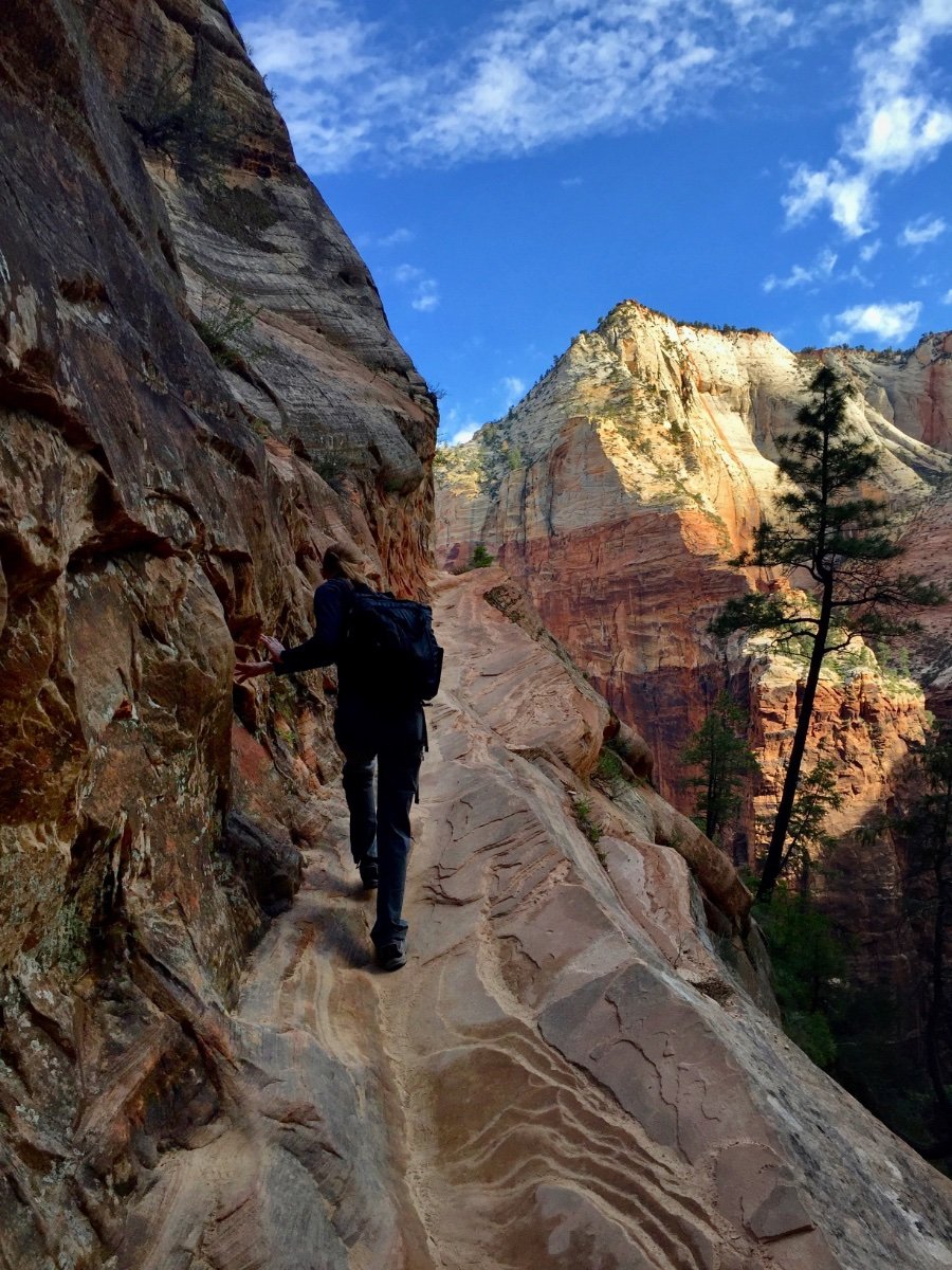
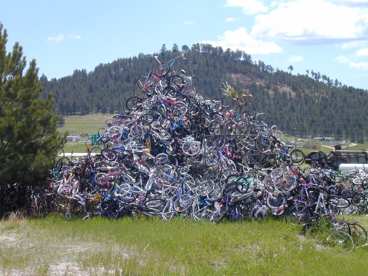
That was actually a little state park in Nevada. Really neat spot. It was recommended by a ranger at Great Basin, and I'm glad he did since it's not the sort of place I'd be attracted to just seeing it on a map - pays to stay open minded. Oddly, for the first time we ran across another Oliver there, and then met the next door neighbor of another Ollie owner. The slots are mud, and so constantly changing. Most are pretty short, though a few offer some surprises, if you're comfortable with tight squeezes... Angels landing is a must, though we have some friends who went to Zion earlier this year and didn't do it. Not sure we can talk with them anymore. But I liked Hidden Canyon more -no chains! - but unfortunately it's closed now after a rockslide, perhaps permanently I've been told: Not sure I'll go out of the way to see the bicycles. But if it's on the way, I can be a sucker for a good roadside attraction if it's weird enough. But really I prefer my weirdness in rock form. Anyone familiar with this hidden moonscape?
2 points
-
The majority of trailer owners who own a trailer capable of Boondocking off the grid... have no idea how to find or locate a Boondocking Site. Western States were once defined as being west of the 100th Meridian. These States have the majority of 'Public Lands'. These are Bureau of Land Management (BLM), National Forest System (NFS), State Lands (usually School Section 16 in each 36 Section square miles and of course National Parks, Monuments, Historical Sites, etc. Boondockers looking for Public Lands have some very good references available. The most detailed are those sold by the United States Geological Survey as Quadrangles. Some outdoor sporting shops sell them as well for local needs. These are for very detailed maps for small areas. For myself, I find the Delorme Atlas and Gazetteer very handy for States we are exploring. They will indicate in colors various land ownerships. City, town, Indian Reservations, BLM, NFS, School Sections and Private Property within public lands. The scale on most are one inch covers 4.7 miles. Some vary and the scale is printed on each map. Roads are consistent as to Highway Interstate and State, County and all season, improved and unimproved BLM and NFS to jeep trails. After exploring an area, you will understand there are differences from those who mapped New Mexico and those who mapped Wyoming. So... experience is learned by actually doing some unplanned side trips. These 'side trips' are where you set up a Base Camp with your trailer and drive further into a remote area to discover those... hidden Gems that you may visit often over time. Often campsites in public lands are marked on a map. One may be displayed on the map, but ten may be located on the way. It appears to be random, but if marked on the map, the campsite may have a water pump and a pit toilet. Some have a picnic table. Some have... nothing but pullouts with gravel. An Oliver can manage about any of these easily. Once a trailer is longer than 25 feet it becomes more difficult as these older camps are intended for smaller trailers used before 1980... or 1950. Often there are 'hunter camps' that have open areas that the largest trailers can easily move around and find ample room for one to twenty trailers. Experience is 'King'. There are Geological State Maps sold by each State if you are a rockhound. The BLM and NFS sell maps of their area offices and sometimes in the general area with their road marked with a number system. The longer the number, the worse the road... kind of plan. At times the smaller roads no longer have a sign. It fell apart decades ago. But, still the maps are very handy. Always mark your camping spot on the map. We add the elevation, as well. Describe the location and if you liked it... or did not. It can come handy if you want to quickly stop on a trip through the area years later. We use our previous locations, frequently. Some locations we revisit often. What are your map preferences? How does it work for you? Has a map taken you to lakes, rivers and creeks that you would have not visited? Early explorers recorded their travels before roads and maps. They made accurate maps and sold them to those wanting to travel west. Much like the Oregon Trail... many discovered better routes and sold maps. Technology has improved maps. GPS is wonderful... if you recorded the location for future reference. Great for get togethers and reference.1 point
-
You cannot get LOST on the Prairie, only confused. "Where am I" is not what the family wants to hear. They are already terrified. OK? North is where it always has been. Same with the other directions. Find Landmarks and know what direction they are from where you are presently. Have whoever is following the map follow the road. You will also see it on the Tow Vehicles GPS... sometimes. Your clearance is better than most of ALL AIrstreams. We have a 3 inch lift to make up for the low clearances. It is the Length that gets you into trouble. Dragging the rear... is for tired hikers and for low clearance trailers. Olivers... you will have to work at dragging the bumper. Travel in twos. Safety in good company, Too much company, three or more... too many different likes and dislikes. You cannot fly fish in the desert. You cannot swim in the Yellowstone River... unless you want to drown in Montana. Those kinds of others... Have company that likes to do what you are doing. We have not found anyone... once and we never see them again. 🙂 It is hard to describe. OK? Planning? Nope. Not at all. We do not know where we will be going or getting lost at. RV Parks for those owners who like RV Parks and tourism. We have our trailer to Explore and create an Adventure, if we planned or did not plan to discover unknown 'ends of the road'. Next time going in the Rocky Mountains region. No Plans. Plenty of DeLorme Atlases. Food, Water, a couple good hats in the event one blows off the cliff, and comfortable sandals, shoes or boots. I climb with my sturdy Sandals for decades. My mountain boots had their purpose...now they hold the floor down in the closet. Not inspired, yet? That tells me you are not interested. That is good for your safety and comfort. This is not for everyone. Maybe less than 15% of trailer owners. Crowds? Only if you are giving away Free Flathead Cherry Pie along the Yellowstone River... I am only showing you those photos to discourage some from trying this. If you saw only the 'End of the Trail 'photographs... I would have to find a small place to camp, as everyone and their ATVs and idling Generators... it is NOT the End of the Road. It is the Bye Bye beginning. You can do this. Well, maybe after a few mistakes, but the best is out there for everyone. Take a deep breath... if you coughed... maybe the dust will not do you well.
1 point
-
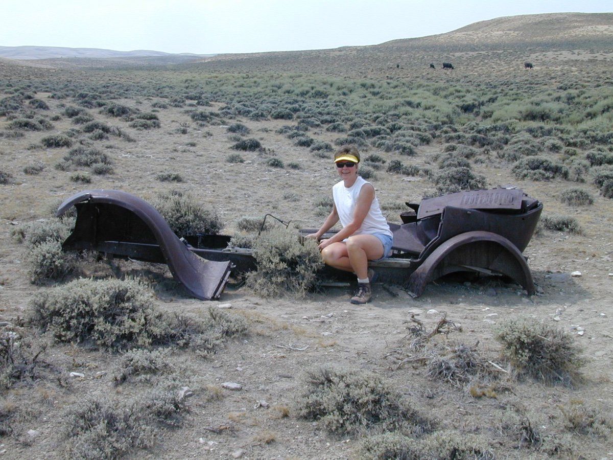
Wyoming had few paved roads in the 1920's. When a Tow Vehicle broke down... it was left in the Red Desert. If you ran out of gasoline, you could hire one or two horses to pull you into the closest town. You often camped in a tent along side these early roads. We have found some of these early campsites in Central Nevada and they would leave bottles and cans as a 'gift to those' who own an Oliver and live in luxury beyond... these Pioneers autos and homes! Enjoy and to to places you have been afraid of visiting or exploring. These people did it... and only a few had to walk. Some were pushed into ravines to keep erosion from doing any more damage. Great for parts if you knew what kind of vehicle it may have been. This one obviously did not... start. We tried. It had wooden door frames. These early roads were Wagon Trails, Cattle Trails or two rut roads to Yellowstone. Wagons were either pushed into Ravines, or burned. Vehicles abandoned were scavenged for parts for years.
1 point
-
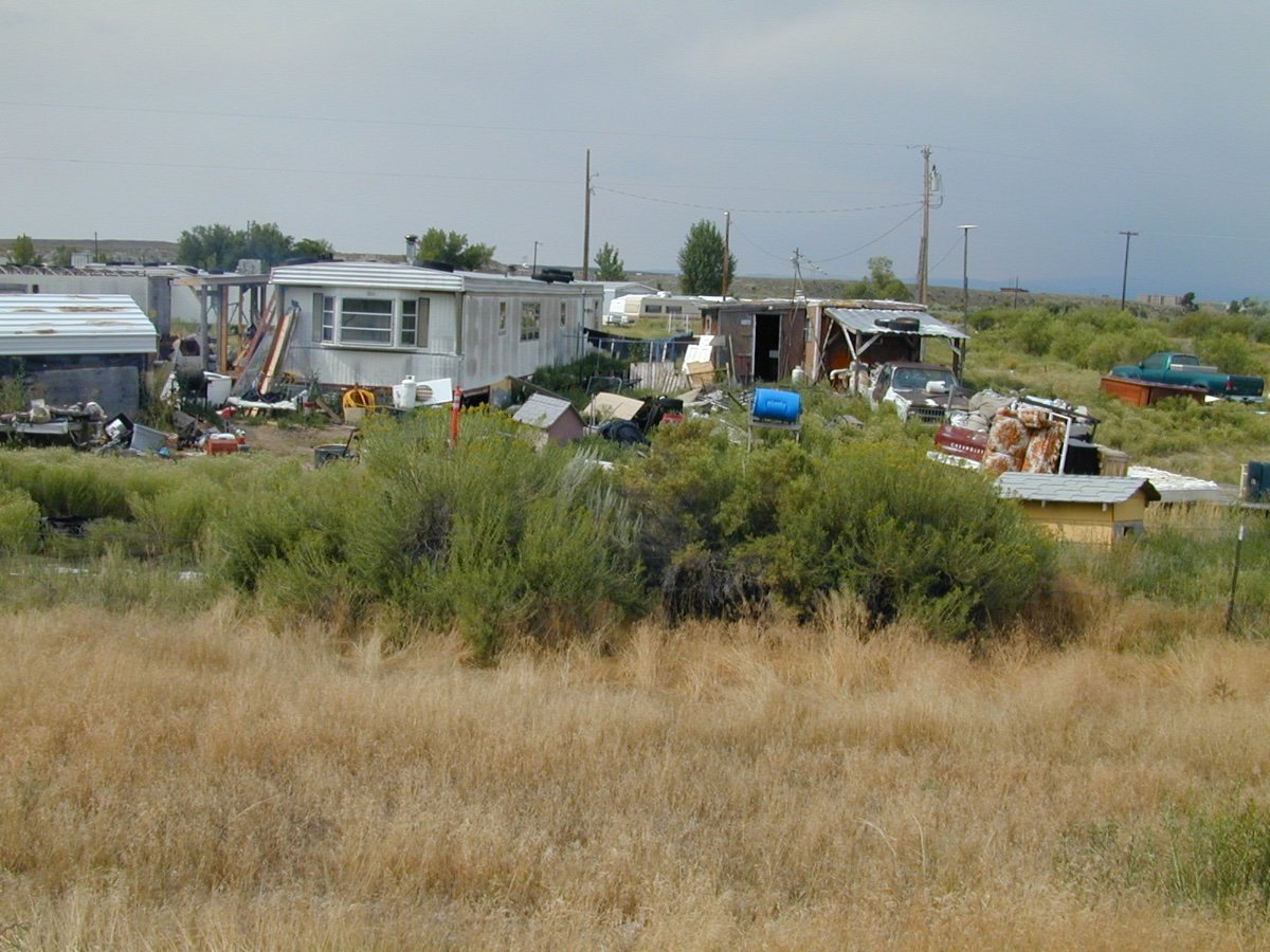
In the Black Hills of South Dakota... Bicycles can be peddled only so far and the trail DEAD ENDS. 🙂 In Wyoming, if used or not, these Trailers have reached the End of the Road. In Wyoming individuals tend to be located at the End of the Road. Some are being lived within. ...and in the Rocky Mountains... the End of the Road is protected from getting there. So Sad 😞 .
1 point
-
Probably just need air in the tires and lube the chain and they're good as new, or maybe not!1 point
-
Quite a pile of bicycles!1 point
-
Just an update here. With kudos and thanks to all in the forum for the great ideas, my reservations are complete for the return trip with the new Oliver. I'll spend about 2 1/2 weeks from my pickup date to meander and return south -- I would have taken more time, except for a commitment at home. My campgrounds will include: Tennessee -- Oliver TT, Davey Crockett State Park, Fall Creek Falls SP Alabama -- Lake Guntersville Florida -- Three Rivers SP, Silver Springs SP I'm still looking to see if I can find something more remote (or less popular) that has openings in Florida. It's the week before Easter, so busy and late planning. I need a dump station at that last spot, though, so I can empty my tanks before coming home. Unless maybe I empty them at Three Rivers (hmmmm, maybe a good idea). I've not been on the forum every day, because I'm juggling all that wonderful paperwork in preparation for the truck purchase, car sale and trailer purchase (insurance, tags, titles, storage facilities, manuals, mandatory gear purchases -- what fun!) -- but I will continue to try to monitor every few days. The truck is still anticipated on 3/10 delivery, giving me 2 weeks to put on some break-in miles and learn the feel of the new vehicle before heading north. Thanks again to all for the help!1 point
-
Love it.1 point
-
Some other examples of maps and maps. Good sources for FREE maps... local library sales and free book shelves. Also University and College Libraries get paper maps and they will throw them away or put them into an Annual Book Sale. A ten year or one year old Geological Map works for us. A twenty year old map of the National Forest... is just perfect. Many roads were built in the late 1890's to 1950 for access for lumbering, mining, grazing access... and so on. Technology is great...until the battery charge is used up, or just decides to not cooperate. We do not need High Tech Maps and GPS to find a spot to set up our Trailer Campsite. Open area... great. Trees, maybe. Rock outcrops, possibly can fit. I scanned other examples. There are maps for everything, every place and for multiple reasons. Many are made obsolete to those using hand held computer and software. Great... for ME. I carry maps on our trips. They are cheap... if you do not buy them from a Mountain Climbing Shop. Get them used at Goodwill and other similar places. A box for $5 of your area. Give duplicates away. United States Geological Survey Quadrangles can be found new and used for nothing. They are obsolete to Engineers today. You and I are Boondockers. I am not looking for where natural gas lines are located... today. Mountains do not move. Roads get improved over the years. Lakes have shorelines that change... but the roads move when necessary. New dirt roads are added over the years... you will see it. ...and often, Boondockers are finding campsites by accident. Good campsites are NOT on a map, unless a National Forest Campsite designed for... Tent camping with a picnic table. I scanned some other maps. Even local towns have maps of places to see and visit for FREE. The BLM has Free Maps for ATV trails. If you get lost often... maybe have your spouse read the map to you. The passenger is the best 'Guide'. Imagination... is not a good way to find a way IN or OUT of the National Forest. 🙂 Go to your Library. ASK if they have MAPS FOR SALE or FREE. They want to get rid of them. University Libraries have thousands of maps donated that will end up in the Dumpster. (Ask me how I would know. 🙂 )
1 point
-
I'm confused about the furrion adaptor. Do you have a furrion port? Oliver installs zamp port, ordinarily.1 point
-
We purchased a Tow Tuff HD Dolly Adjustable Trailer 1000# Capacity tote from Tractor Supply last year. We returned it after it twisted and began to collapse for a full refund. Charlie.1 point
-
Yes, thank you. We in the Elite crowd are a minority, and reports are hard to come by. The weight of the ascent and a reasonably loaded Elite seem to be a good match. My brother just bought a gas Maverick, and loves it. I'm still skeptical of this as a tow vehicle, but as a daily driver, he lives it, and the mpg. If we do get to Minnesota this summer, I'll see if we can do a test tow with his truck. It would be fun.1 point
-
There is a very cool Harvest Host site in Tallahassee just of I 10. It is a collectable car museum. They have much more than cars. We did this and would do it again. A bit loud at night due to I 10 and busy intersection. Nachez Trace is cool and you can find camping off of the Trace if sites are closed. We did a section in December and you could still park and get out to see the sites. If you do it from end to end consider a stop in New Orleans on the way to Florida. The WW II museum is amazing and is a must see there is a city campground in the French quarter. Noisy but close to everything. We did a swamp tour and has a blast on that.1 point
-
That's Subaru does a very good job pulling your new Elite I, sounds like you have a good combination between the two. We don't get a lot of info on pulling the Elite I on the forum, so glad you posted this for new owners of the Elite I to see. Sounds like your set for some camping fun. trainman1 point
-
Build sheet sent. Wallet lighter. Colors picked and street awning included. Thanks to all for the feedback! Can't wait to get a hull number!1 point
-
I agree with topgun2, I've used the EezTire E518 TPMS now for about 2 years. Sits in the cup holder just fine and the Ascent has soo many cup holders, but I can understand why one might want to make it more OEM.1 point
-
Only Oliver Sevice can tell you for sure, but it looks like the standard Dicor Self Leveling sealant used on RV roofs everywhere. It is quick and easy to apply, so less man hours, and it looks like crap. I personally would be quite pissed if they did that to my trailer. That is for stick and staple Elkhart trailers with rubber roofs. It requires routine inspection and touch up. https://dicorproducts.com/product/epdm-self-leveling-sealant-for-manufacturers/ Trailers with “boat hulls” should get marine sealants. I will probably never return to the factory, but if I did and they were going to seal something up top on “Mouse”, I would tell them what type to use and have them charge me for the extra cost and labor. John Davies Spokane WA1 point
-
Nicely written report. Thank you. I will say I also cringed when you talked about speeds from 70-75 MPH. Having a trailer in tow adds so many variables to the equation that I want a little extra safety buffer if something goes wrong. RVing is supposed to be relaxing and fun. I'd rather take my time and arrive less stressed.1 point
-
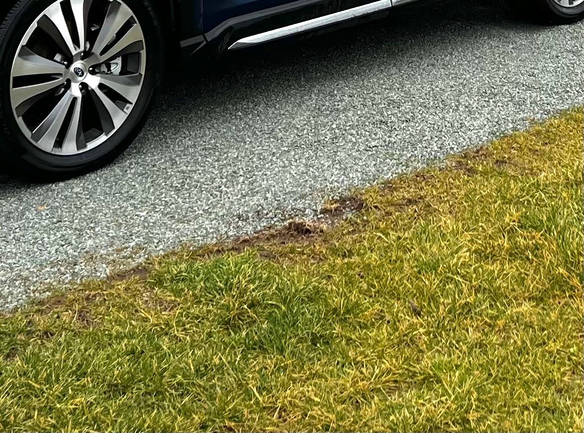
I forgot to ask, this is off topic a whole lot, how is the grass holding up at the Oliver CG? It looks pretty bad in your pic; from images posted last summer it appears that the contractor laid down and compacted a huge gravel parking lot, then put sod directly on top of that to delineate the campsites.. 😳 Zoom in and study the grass, I think the first time somebody tries to mow it, the sod is going to lift up into the mower deck. It appears to be a “low bid” job… Also I quite like your wheels, I am looking for a set of Acura takeoffs like yours. Now back to your towing thread. John Davies Spokane WA
1 point
-
My TPMS (EEZTIRE) has a re-chargeable internal battery that lasts up to 60 hours of active monitoring (the monitor shuts itself down if the tow vehicle is not moving and restarts automatically when moving) which equates to about a week of actual travel time. Certainly it can also be hardwired but I've not done that due to the ease of use without having even more wires to deal with. If your TPMS has a re-chargeable battery you might want to consider giving it a shot before doing the work of pulling those wires. Bill1 point
-
Nice write up. Seems your set up fits well with smaller Elite. I share the concern over braking - I would give the system a good test - just to ensure the worst case is manageable. Towing at 70 with a larger vehicle is much different than with a car based platform. Good travels RB1 point
-
I’m impressed that you could return over 13mpg with the engine holding 3.5-4k rpm’s! Thanks for the detailed report, could you provide the payload capacity shown on your door jam sticker?1 point
-
I have been using RVParky for my trip planning lately. It is free. You program your route (town to town). At each stop, you can then cllick "Find a campground" and see what CG's are available near each town and it has reviews by other people that had visited that CG. RV Parky will tell you the distance between your stops and total route distance and the time of travel. It will also give you an idea of the amount of gas used on your route. I have planned a few trips but have not tested it yet, but will be making my trips this summer, fall and early winter.1 point
-
Kirk - If I were in your shoes, before I spent a bunch of time, trouble and money switching from one solar controller to another (interior) I'd study the differences between these two types of technology. From what I've read, the differences are very small - in the real world - and would take considerable time to recoup any real difference in performance. The reason Oliver switched from using MPPT controllers had more to do with simplicity for the user/owner than it did with anything else. Bill1 point
-
The exterior solar port that Oliver installs does NOT run through the Zamp solar controller. This exterior port connects directly to the batteries and, therefore, any portable panels must have a charge controller of their own.1 point
-
https://travelnevada.com/cities/jarbidge/ It's officially Pacific Time, like all of Nevada, but the town uses Mountain Time because the only way in year round is through Idaho, the pass south to Elko is plowed for their July 4 celebrations, and gets snowed in again in October... 😉 The route from Boise to Jarbidge is about 70 miles of smooth gravel ranch roads, with random water ditches across it, to keep you on your toes. What fun. The route there from the east is all paved, with several campgrounds. You should check it out: "For many anglers, catching a wily bull trout is the final leg of the IGFA’s “Trout Royal Slam”, and if you find yourself in the spectacular Jarbidge Wilderness during summer and fall, you may just hook into one of these olive-green beauties in one of the best fishing spots in the Silver State." https://travelnevada.com/fishing/jarbidge-river-trail/ John Davies Spokane WA1 point
-
Impressive photo of the Narrows... even more so looking down! Yikes... This year there were several Flash Floods this Summer... if you see any chance of rain... do something else. There are Slot Canyons at Zion, but also near Kanab and other areas of sandstone erosion. Some are very narrow and you have to squeeze through. Top 10 Slot Canyons of Utah is a good place to search. A United States Geological Survey professional paper 220 of Zion Park that has everything you would want to know and maps... copies are always for sale on the Internet and no doubt some to load onto your lap top computer. A photo of people in these Natural Wonders are always fun to see. Post more. How about Angels Landing at Zion? The FIRST time... you will not forget. 🙂 Oh yes... been to the Black HIlls and seen the Mountain of Bicycles?
1 point
-
Another situation where a map wouldn't be much use. Nor GPS. I hope everyone is carrying a long piece of string. 😝1 point
-
I learned about the Avenza maps app when I cruised out to Pawnee National Grasslands this spring. I wanted dispersed camping, but the local forest service office was closed due to COVID. Thankfully, they pointed me to free forest service maps on Avenza. They show in great detail what areas are open to dispersed camping. If you can boondock, dispersed is the way to go in the west. https://www.avenzamaps.com/mobile-maps?campaignid=10221828697&adgroupid=102940455500&adid=453328850375&gclid=CjwKCAjwlID8BRAFEiwAnUoK1e_S1UVHaVpOOzhKxzPx9ByrWrbkUypIRjAtl3ENXqNyFO9sRcFw9RoCI58QAvD_BwE There's an app for that!1 point
-
Whatever the service department used last year to "re-caulk" our 2020 still has a tacky surface and collects dust and road grime. It does wash off but looks terrible after each time out on the road. Additionally, that sticky excess that was wiped off during the re-caulking makes it look like the caulking gun was given to an impatient teenager. Charlie0 points


-
Recent Achievements
-


")


")