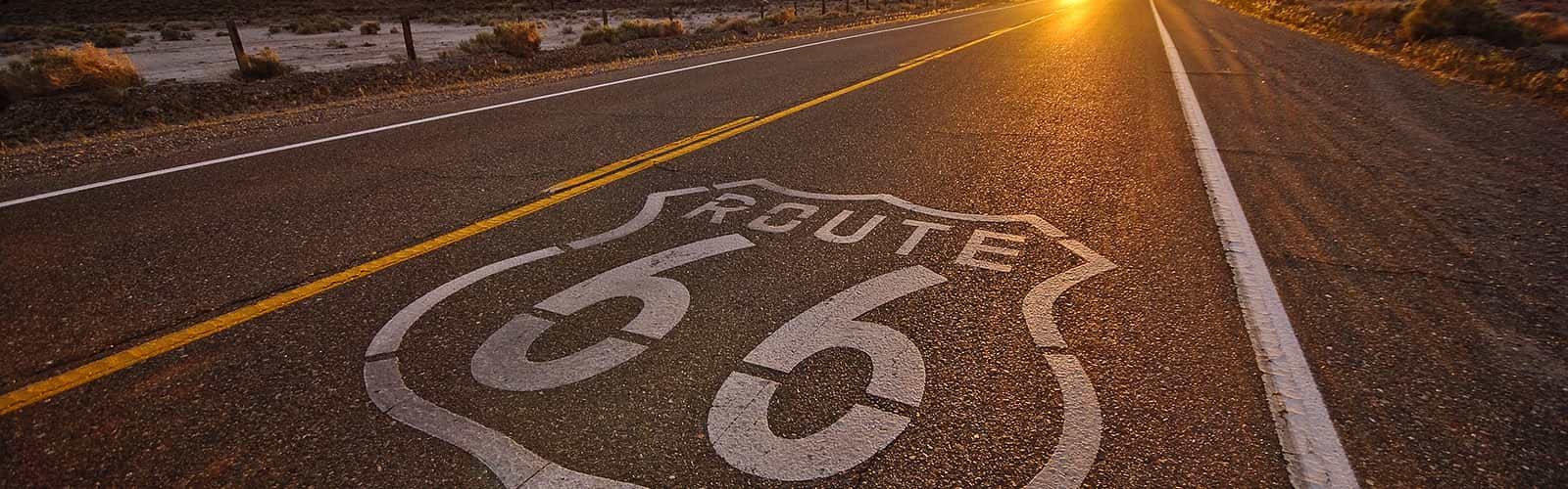
Route 66 is a slice of American history
In 1925, Congress passed legislation creating the East/West artery linking Chicago to Los Angeles. During its early formative years, Route 66 had several different passages. Only when Eisenhower saw the German Autobahn Did it become the major highway linking America through government funding support.
In the 1939 novel Grapes of Wrath, John Steinbeck named Route 66 the “Mother Road”. As an American epic odyssey, Steinbeck told of the Joad family as they traveled from Oklahoma to California during the post-Depression “Dust Bowl” days. This Pulitzer novel was my compass in my recent journey down Route 66. My father was a native Texan and traveled west as a child with his family to settle in California during the height of the Dust Bowl, much like the Joad family.

After WWII, my family often traveled Route 66 from California to visit my Mother’s family. We lived near LA, and our driveway was on Route 66. Along the way, my father often pointed out places where his family “camped out” on Route 66. Before WWII, he was in the CCC and had helped build some of the facilities in National Parks near Route 66.
Route 66 is a slice of American history, told by Will Rogers in his museum on Route 66 by President Eisenhower as he passed legislation to strengthen American commerce by creating a national transportation highway system and by many stories.
Today, Route 66 is not just a road, but a national monument. Its preservation is a testament to the dedication of the National Parks Service, ensuring that this shared American heritage road remains open for all to explore. As you traverse Route 66, you’ll encounter a vibrant mix of cultures, with many languages spoken in the diners, hotels, and attractions that dot America’s highway, the Mother Road.
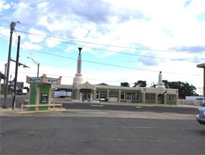
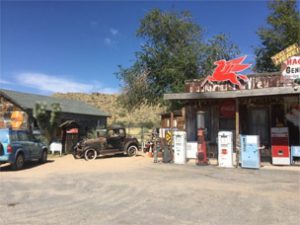
When I was a child, we drove Route 66 from Victorville, CA, to Guntersville, where my mother’s family lived, many times. I always bugged my father to stop at the “Spaceship” gas station below.
Now that Route 66 has been designated as a national monument and federal matching funds are available, many road icons are being refurbished. The Spaceship gas station now houses the local chamber of commerce.
For years, restaurants, hotels, and gas stations met the needs of travelers across the U.S. from East to West. The curios, collectibles, and snake oil purveyors were quite prolific along the highway, selling to unsuspecting tourists. To attract the eye of motorists, the buildings were adorned with bright colors. The sharp salespeople would put a large object like a horse or buffalo out front. The perfect ones would shape the entire building like a whale, Teepee, or Dinosaur. This would ensure the children would drive the parents crazy to stop, much like I did as a child. Fast food did not exist. You stopped and ordered, and then the food was cooked and served. Picnics at a wayside park or on the hood of a car were the preferred restaurant if you were to make your destination on time.
When Eisenhower became president after WWII, he passed a bill that created the national interstate system. This spelled doom for Route 66. Today, travelers can go thousands of miles on an interstate and see nothing but the McDonalds and gas stations just off the road. Towns along Route 66 fought the building of the interstate. I remember traveling on Interstate 40, having to get off and drive through town on Route 66, only to get back on the interstate just on the other side of town.
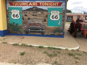
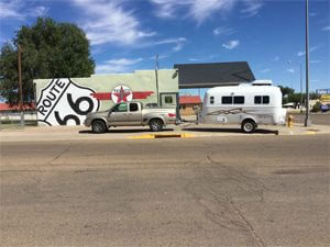
Below is some of the artwork along Route 66. Because Route 66 has been deemed a national monument, many icons along the way are preserved as a national treasure and qualify for federal dollars to pay for restoration.
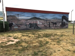
Route 66 is well promoted in Europe and other countries. Many tourists on Route 66 are from somewhere other than the U.S. As I took some photos this morning, a large tour bus stopped full of people from Germany. Soon, another group from the U.K. stopped.
Many of the businesses on Route 66 flourished because they met the needs of the travelers. Providers like Cline’s Corners were icons that sold food, groceries, ice cream, and trinkets for kids, such as MiniTonka moccasins. They still flourish today and are more significant than ever. It is now a large truck stop and restaurant and still has the trinket store.
On the other end of the spectrum is Route 66 Casino. Built on the edge of the Hopi Indian Reservation and adjoining Route 66 highway, offers very little to travelers.
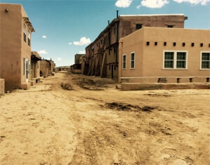
Acoma Pueblo, New Mexico
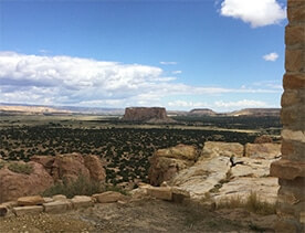
The Acoma Pueblo Indians (pronounced ak-o-ma) have occupied this pueblo on top of a 380-foot Mesa west of Albuquerque, NM, since 1080 AD. They have survived attacks from their Indian enemies, Spanish and Americans. As the Spanish Conquistadores approached the high Mesa, the sun shone on the Adobe village, and they appeared to be made of gold. The town was attacked several times over 250 years. The last attack was successful. The Acomas could sustain life in Mesa because they had abundant water pools, gardens, and animals. To this day, 13 ancestral families live in Mesa without electricity or running water.
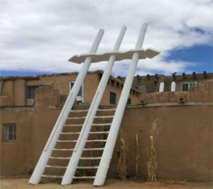
The white ladders signify a Kiva, the heart of the Acoma religion’s place of worship. The religious leaders are all male, and only males can enter the Kiva during the worship service. However, the Acoma culture is very matriarchal. For example, only women can own property. If a divorce occurs (very rare), the male must leave the village.
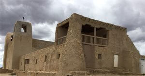
They have a church built by the Spanish. Their services are a mixture of Catholicism, Acoma, and ancestral heritage. I could take pictures of the outside of the church but not the inside or the graveyard. The graveyard is fascinating. It is layered with graves buried on top of each other since early Acoma civilization, accounting for shallow graves stacked more than 40 feet deep. Only leaders/church leaders can be buried; this is the last layer. The Acoma Pueblo Nation is a proud people, tranquil, helping each other, and having a sense of the greater community and family rather than self.
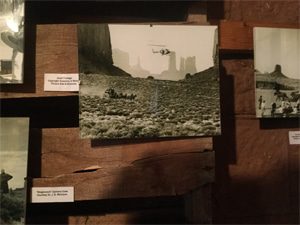
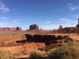
Monument Valley Arizona/Utah
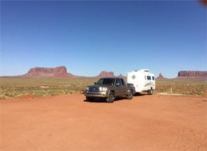
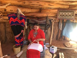
Route 66 does not go to the Grand Canyon; it parallels the canyon, and in some places, especially Peach Springs, AZ, you can look north and see the overhang into the canyon. I have seen the canyon several times, so I wanted to go to Monument Valley on this trip. Below is my “Home away from home.” I could see Geronimo riding across the night sky or the Great White Buffalo. The Navajo Indian Nation owns Monument Valley, which is a centerpiece of the reservation. I found the Navajo lands to be very safe and friendly. The Navajo lady below spins raw wool from their sheep into yarn to make blankets and other necessities.
Many “Western” movies were made in Monument Valley. With little imagination, one can imagine John Wayne in the film. Notice below the helicopter in the photo from the filming of “Stagecoach.”
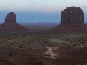
I was in Monument Valley the night of the “Blood Moon.” Above is a picture of the moon rising between two of the monuments. You can compare the size of these monuments with the cars, but it is still some distance to the nearest one. I am high on a cliff, very uncomfortable with height, but the view is priceless.
Winslow Arizone
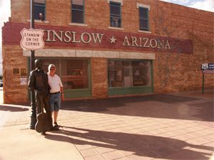
Winslow, AZ, is known for the Eagles Take it Easy song, starting with the lyrics “Standing on the corner in Winslow, Arizona.” Before this song, Winslow was known as the home of the La Posada Hotel and Gardens. Before Route 66, the railroad was a primary means of long-distance transportation from East to West. Several railroad towns had upscale accommodations, both restaurants and hotels. Known as Harvey Houses, Fred Harvey introduced fine linen, silverware, china, crystal, and impeccable service to railroad travel. MGM made a movie, “The Harvey Girls,” starring Judy Garland. Today, La Posada Hotel remains, and Turquoise Room serves some of the finest cuisine on Route 66 or any rail town restaurant.
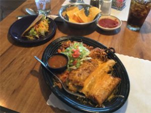
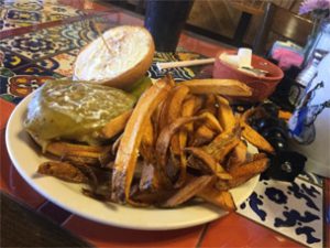
Food
The food along Route 66 is boundless. Chicago dogs, Chicken Fried Steak in Oklahoma, and Mexican/New Mexican throughout the West can best be described as Road food extraordinaire! My favorite is Mexican, but I often strayed into other culinary delights. One of my favorites is a Black Angus burger topped with a whole Hatch green chile and real French fries.
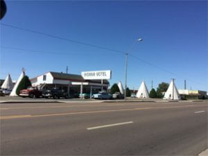
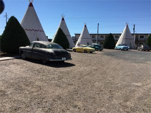
Wigwam Motels
Buildings along Route 66 in the early years were designed to catch the eye of the driver, the children, and others who might be snagged in to buy their wares. Such are the two wigwam motels on Route 66. Pictured here is the one in Holbrook, AZ. The other is located in Ontario, California. The old cars are relics that family members parked rather than a trade-in. The individual Tee Pees are traditional motels with all the creature comforts that most travelers expect, with a bit of yesteryear nostalgia!
Here is a picture of Hackberry General Store, Hackberry, AZ. I remember stopping here when I was a child because it was the only place to buy gas in more than 60 miles, either direction on Route 66. Today, it is more than just a tourist attraction. It serves a small community as a general store, a testament to the enduring spirit of the Route 66 community.
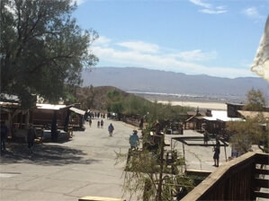
Calico Ghost Town California
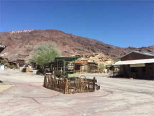
1884, silver was discovered on a hill near present-day Yermo, California, 30 miles from Barstow, CA. Within 6 months, there were 18 registered mines and 100+ miners. The town of Calico was born and survived, even today. At its most robust times, there were over 100 families, 260 miners, 18 saloons, and 10 brothels. Over $22 million annually was removed as silver, and the towns of Daggett and Yermo sprang to life as silver ore processing was needed.
In 1922, a large mining corporation bought the mining interests south of Calico and continued to mine for borax, silver, and copper. After several years of strip mining, the natural resources were gone.
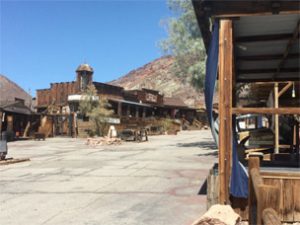
The town of Calico was sold to Knox Berry Farms and repurposed as a Ghost Town Park. In the late 20s and early 30s, my father and his brothers played here as boys. When it opened as an amusement/historical park, we visited Calico. My father told me that the road to/through town was added and improved, and the buildings had new roofs, but otherwise, everything was the same.
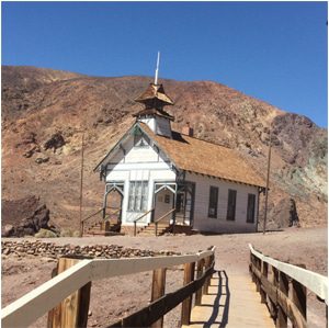
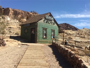
One of the most remarkable structures in Calico is the ‘Otherside’ building, a testament to the town’s resilience. Constructed from whisky bottles and rammed earth, it stood strong even when Calico was ravaged by fire in the late 1890s. Despite the devastation, the building and the school/church managed to survive, a symbol of the town’s determination to endure. Calico was swiftly rebuilt, fueled by the discovery of large silver deposits.
I hope you have enjoyed my revisit to Route 66. I appreciate you taking the journey with me. I drove 4,600 miles roundtrip, spent 4+ weeks on the road, gained a pound or two, and despite the thunderstorms I went through, I had NO ISSUES with my Oliver Travel Trailer. It performed exceptionally well.
Route 66 is not about the destination, but rather the journey itself