Leaderboard

Popular Content
Showing content with the highest reputation on 07/23/2018 in all areas
-
http://www.liveworkdream.com/2018/07/23/walmart-free-camping-spot/ Probably about time. The whole process was so abused. Far too many RVs vs shoppers. And why? At least three beautiful yt parks within fifty miles... Last few times, we were appalled at the number of RVs, obviously bmany staying far more than the one free night... Sherry1 point
-
Hello folks, I have 2 dogs so I also grappled with this concern. I have been using the Tempstick (described in the list provided by ScubaRx and reviewed by Long, long Honeymoon on YouTube). Tempstick does indeed need a wifi hotspot. It can be set to alert me as the temp reaches a setting of my choice AND I can monitor in 'real time' from my phone whenever I wish. The setup was very easy. The customer service was excellent when I had questions before and after purchase. I try to be VERY careful to not leave the app 'open' on my phone as it will continuously send/receive and use significant amounts of data! (an oops that goes cha ching!) Realistically, there will be areas where there is a weak or no signal. In that event I plan to simply forego leaving my dogs unattended. The initial cost for the Tempstick, the cost of the hotspot and the added $10/mo for said hotspot has been well worth it for me. Hope this helps! Happy Trails!1 point
-
Thanks Bill & Tom, I have sent Ewa a copy of Jason’s Service bulletin, figuring she may not be aware of the issue. I also mentioned that others experiencing this problem have reported receiving a full Oliver replacement package. My initial email gave all necessary info regarding our Olver so we will see what happens next. Just in case, We’ve put in an Oliver service request for the appropriate measurements to send to back to Automotion. Ewa’s communications have been very pleasant so I’m sure we will get this worked out. Appreciate your help! Kathy1 point
-
Ours was the same as Bill's. Never asked for measurements, Just wanted to know if it was a Elite or Elite 2. Here is his response "I presume the address you provided below will be the ship to address ? I will need to know the model you have - elite 1 or elite 2"1 point
-
I emailed Alex and told him that I had a 2018 Oliver Legacy Elite II with “slits” in the window shade fabric. He responded saying that they were running about a month behind. I never told him how many I needed. Almost a month later to the day I received 4 new blinds. He never asked for measurements. Probably the best customer service I’ve ever had. Bill1 point
-
With our dog inside we always put our Maxx fan in the auto position in case of a power failure or A/C failure. The fan runs off the batteries and when in auto will come on at 78 degrees (factory preset) or whatever temperature you have it set at. In case of a power failure the fan will start at the preset temp and come on. We leave the bath fan vent open so it can suck some air in through it if needed.1 point
-
Hello Oliver Friends, I know some of you have camping plans in Colorado in the near future. We have had a dry winter and spring, and wildfire season is off to an early start. There is a large fire burning near Durango and portions of the San Juan National Forest have been closed. A new fire began today on Buffalo Mountain in Summit County, which is an area suffering from severe beetle kill, so that fire could grow quickly. There is smoke haze west of the fires to at least were I live in the Denver foothills. I recommend you check on the area you are headed to before traveling to make sure there is not an active fire in the area or air quality issues. Here’s hoping for some rain! Alison1 point
-
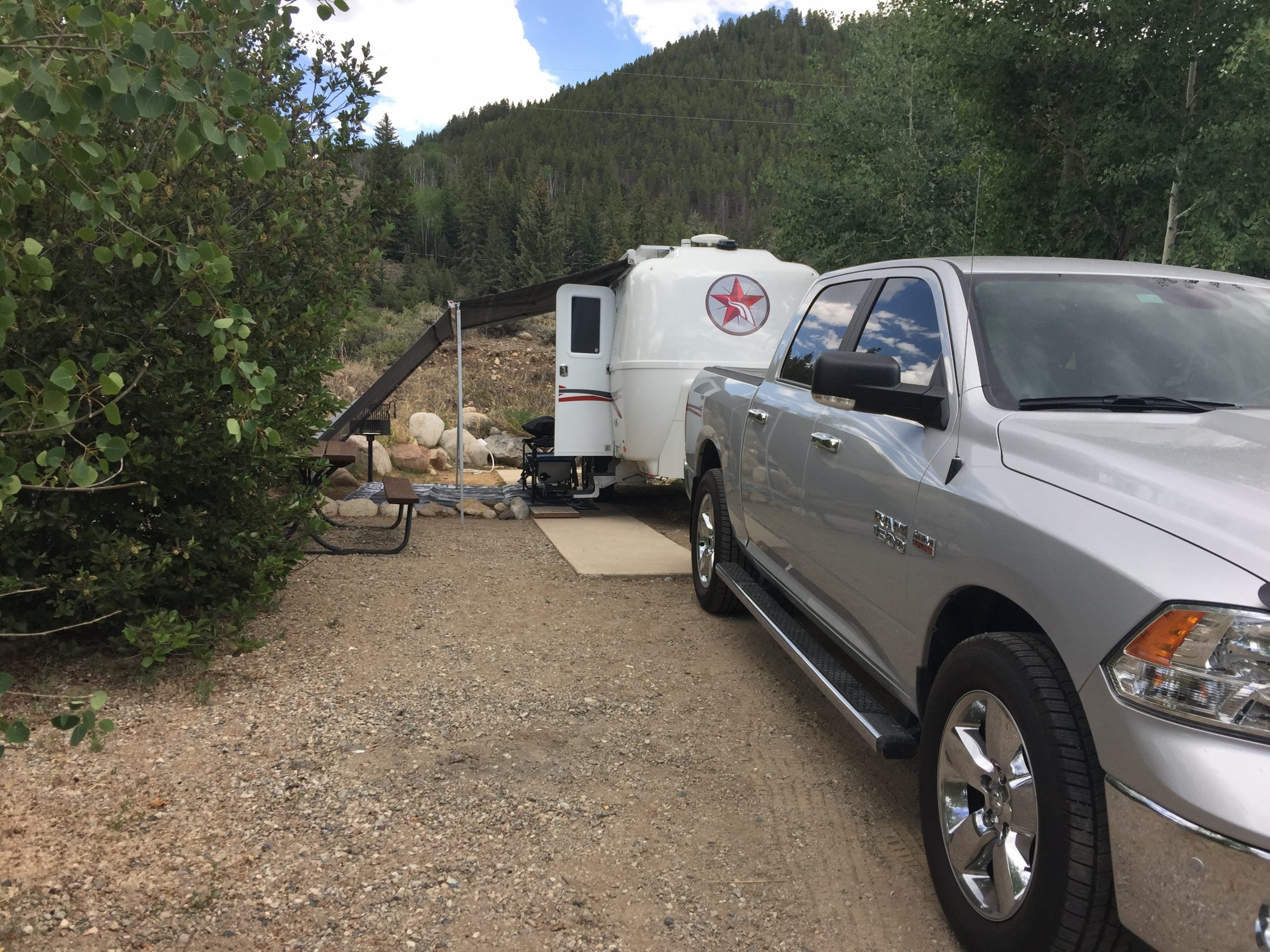
We’re camped in Almont, halfway between Gunnison and Crested Butte. Showers most of today, more rain tomorrow. Hopefully the rain will help with the drought and fires. Mike
 1 point
 -
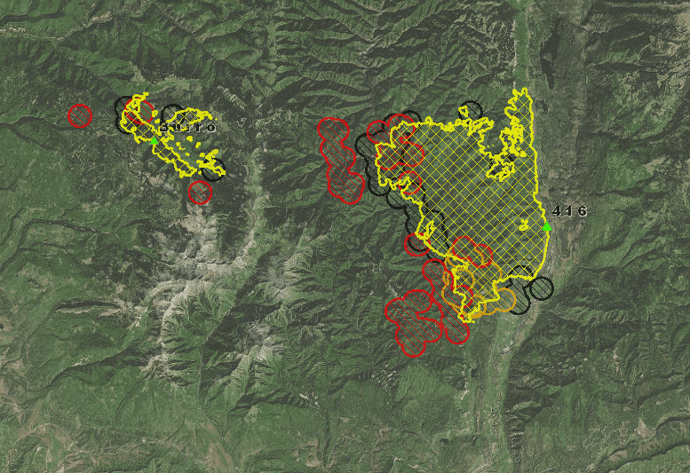
If we're in or headed to an area with active wildfires, we use the GeoMAC website for monitoring conditions - it's really useful. Use the main map to locate individual fires, then use the drop down menus on the upper right to zoom in. You can then use the data layer menu on the left to display all sorts of info. In particular, if you compare the fire boundary with the satellite detection layer, you can get a good idea of which way the fire is headed. For example, the 416 fire looks like it started along hwy 550 and is headed west and south. [attachment file=Screen Shot 2018-06-13 at 9.17.12 AM.png]
1 point
-
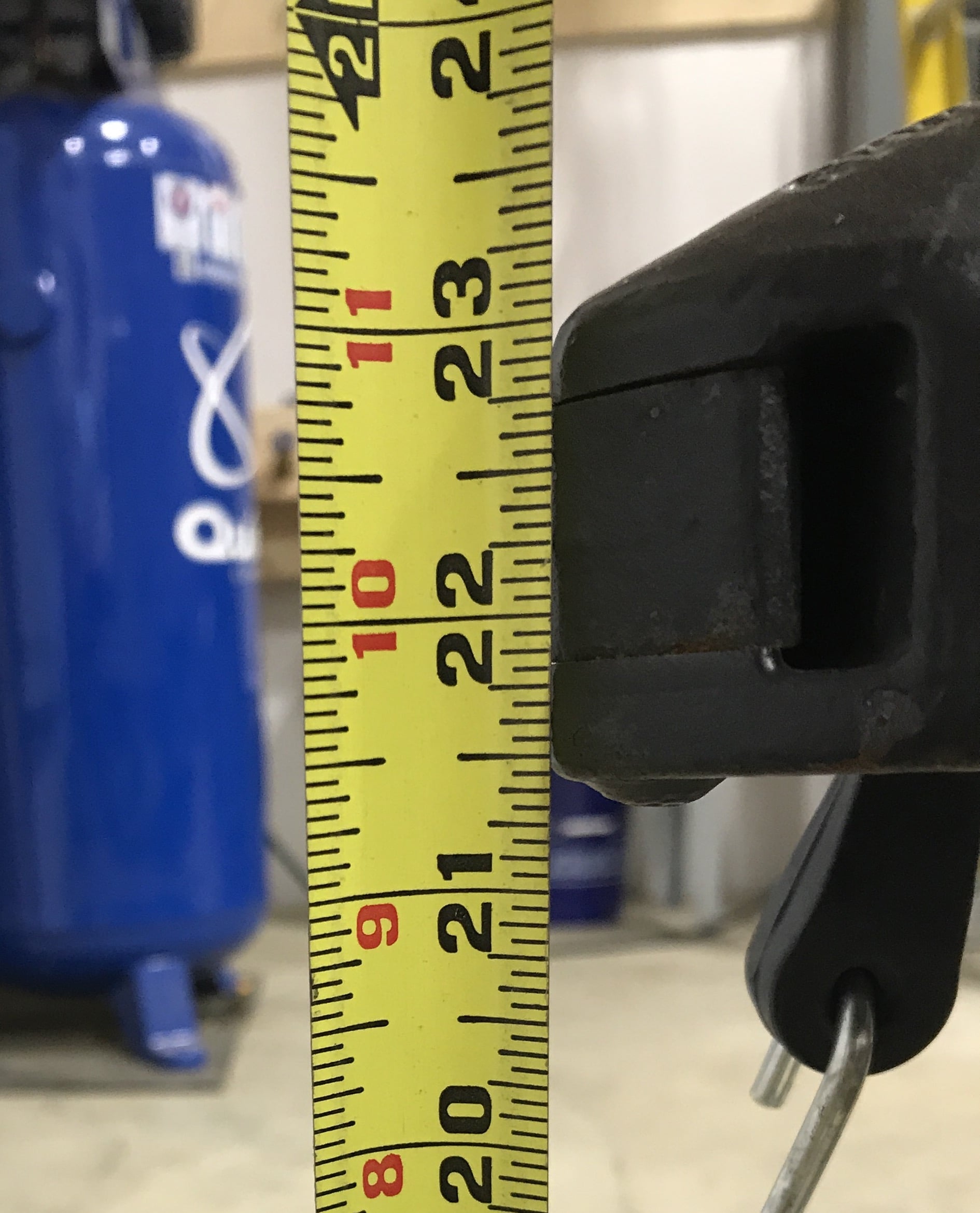
My 2018 OEII is sitting level on a level shop floor. Here is a picture of the hitch. I would say 23.5 inches from ground to top of a 2 inch ball would be correct.
1 point


-
Recent Achievements
-


")


")