Leaderboard


Popular Content
Showing content with the highest reputation on 12/29/2019 in all areas
-
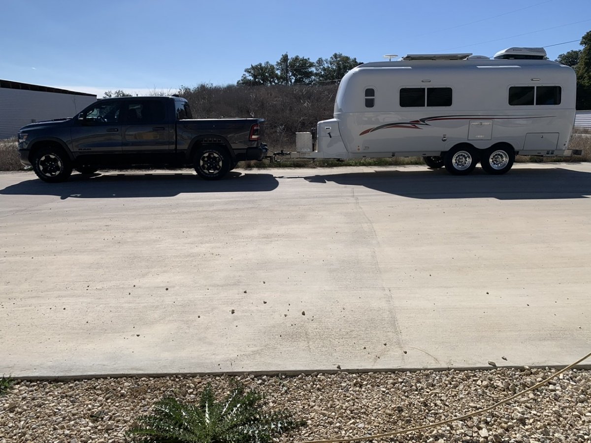
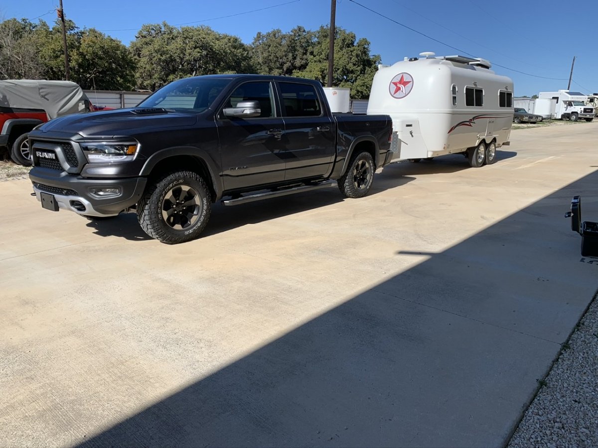
Drove over to the trailer today to adjust my Andersen hitch to the new truck which sits over an inch taller than the 2016 Ram. With no adjustments it was 25.5” to the top of the ball. I was in the bottom two holes in the ball mount so I had to remove the ball assembly and flip the mount over to use the top two holes. That made the top of the ball sit at exactly 23.5”. When I lowered the trailer the truck went down about 1.5” without the Andersen. With the WDH it was just above 22.5” at the top of the ball. When I used a level on the trailer, it was right at level. That is with an empty truck. Once I load the bed with camping stuff I should be very slightly nose down. We’ll load up this weekend for a Monday departure to points west for Jan/Feb and should get a better idea if any adjustments are needed.
 2 points
 -
Heres one for you guys. This is literally the only reason I keep a smart phone at this point. We started using it for hunting of course but now we use it for everything. There are pockets of public land everywhere and its dead accurate in showing you. We use it for simply pulling off the road somewhere or to find huge blocks of land to explore. Downloading maps and adding POI's offline is awesome. For example we can float 100+ miles down a wilderness river and mark all the best camps, hot springs, rapids etc along the way. As soon as you log in once you have service it updates everything seamlessly. Best app I've ever used and its nice to support our local Montana businesses. https://www.onxmaps.com/2 points
-
We upgraded the mattress after being on the road for 45 day. We then went on the road for 30 days with upgraded mattress purchased from Oliver. Slept terrible with standard mattress and sleep great with the upgraded mattress. We prefer a stiffer mattress and the upgraded fit the bill. Next, we need to upgrade the dinette cushions. By nature, I am a frugal person. It bothered me to spend the extra money o a upgraded mattress. However, it was well worth the additional cost.1 point
-
I watched it already. I was in hopes of finding someone on the Oliver forum that has first hand experience with it.1 point
-
Its $99 a year if you want the nationwide plan. If you just want to dabble for a while, you can play the free trial game. Its pretty easy to put your account on hold and just keep trying out each states free trial. If you travel a lot or even a little really, the $99 a year plan is a no brainer in my opinion. If you're just traveling a month at a time or less, its $15. It works on Iphones and android, beyond that I have no clue.1 point
-
Looks like that bridge could use a warning system like this one in Sydney. Approaching truck height is measured by sensors. Overheight vehicles trigger a giant stop sign projected onto a wall of water and air-- impossible to ignore. Quite cool. https://www.truckinginfo.com/158996/aussies-deploy-water-wall-tunnel-warning-technology It's also deployed when there's a fire or accident in the tunnel. Emergency vehicles can drive right through, of course, since it's only water.1 point
-
Hi Mike, yes, the main advantage of such apps is that you can download maps when you are at home using high speed wifi, so when you are in the boonies, the data is already there and ready for use, there is no need whatsoever for a cell signal with its expensive cellular data. Cellular driven nav apps like Google Maps work OK when you can connect. When the phone goes dead you need to have other map data to use. If you are using a tablet like an iPad, it must have a cell chip, otherwise the gps tracking doesn’t function. OTH, Pocket Earth has Wikipedia data (links) that you can download. When in cellular range you can click an icon and get an immediate summary of the point of interest. It saves time since you don’t have open up a browser and search for it. John Davies Spokane WA1 point
-
We just had the service done (currently staying in Phoenix AZ). Dexter was great, very responsive. They helped us find a local service provider and worked directly with the one we chose to confirm the service and handle payment. As pleasant as it could be under the circumstances. For what it's worth, none of the nuts were loose when I inspected before the service (I also found the bottom nuts to be difficult to access).1 point
-
I do not care for the Delorme atlases, I find them to be WAY less useful (recreationally) than the Benchmark ones. Unfortunately there are only 13 western states available. I have all of them except for Texas and Alaska. https://www.benchmarkmaps.com/atlases However, they are a great tool for research and a final backup in case my electronic devices fail. I use 1/4” stick-on colored dots to mark points of interest and major turns. My iPad Mini 4 has a number of camping and nav apps on it. I have tried most and deleted many.... The one I most recommend is GAIA Premium ($40 annually) since the Layers function lets you add just about any kind of info, like Forest Service MVUM (Motor Vehicle Use Map) data, which will tell you where you can and cannot drive. I can’t stress enough how important this is. GAIA is OTH pretty rotten for simple road navigation. The other app I use all the time is Pocket Earth Pro. The basic app is free, the Pro upgrade is $5 and adds topographic maps. For just driving away from urban areas where your cell phone is dead, it is wonderful. The graphics are very pretty and the thing that sold it for me is the user adjustable font size. You can make the city and town labels almost any size you want, and they are dynamic. When you zoom out they get bigger too, so older eyes can easily read them. All other similar map apps I have tried do not have this feature. Map downloads are quick and simple and you can use the app anywhere in the world. GAIA is for really hard core users, Pocket Earth will be useful for anybody. Try it out, see if you agree. https://pocketearth.com/ That said, for routing on normal roads I use a Garmin RV gps. It is way better than the factory nav systems I have seen. Plus the maps are free and updated quarterly. My 2013 Toyota maps are pretty lame, and they cannot be updated without a very expensive trip to the dealer. John Davies Spokane WA1 point
-
Yes, those guys in Service are amazing. I had a small spot (about 1.5 inches in diameter) on the roof that needed repair. After they were done I can't really tell exactly where the damage was. However, just as with a re-painted car, many times the color simply will not match exactly and in the right light it will look different either due to the color or the sheen as Overland points out. Bill1 point
-
look at my handle, What are shoes? (-:1 point
-
Depends on what else you have in there. We keep a door mat inside by the front door which is where dirty shoes and boots get left. I also installed a long net under the street side bed and we keep camp shoes there. It keeps them convenient and off the floor.1 point


-
Recent Achievements
-


")